So yes, this is one walk we can't stay away from. March 2015 marked our sixth crossing in approximately 18 months, and somehow I don't think we are showing any signs of slowing down.
This walk saw Claire, Dave and myself do the walk walking west to east, which was definitely a good idea as we had a decent tail wind for the most part on this blustery weekend.
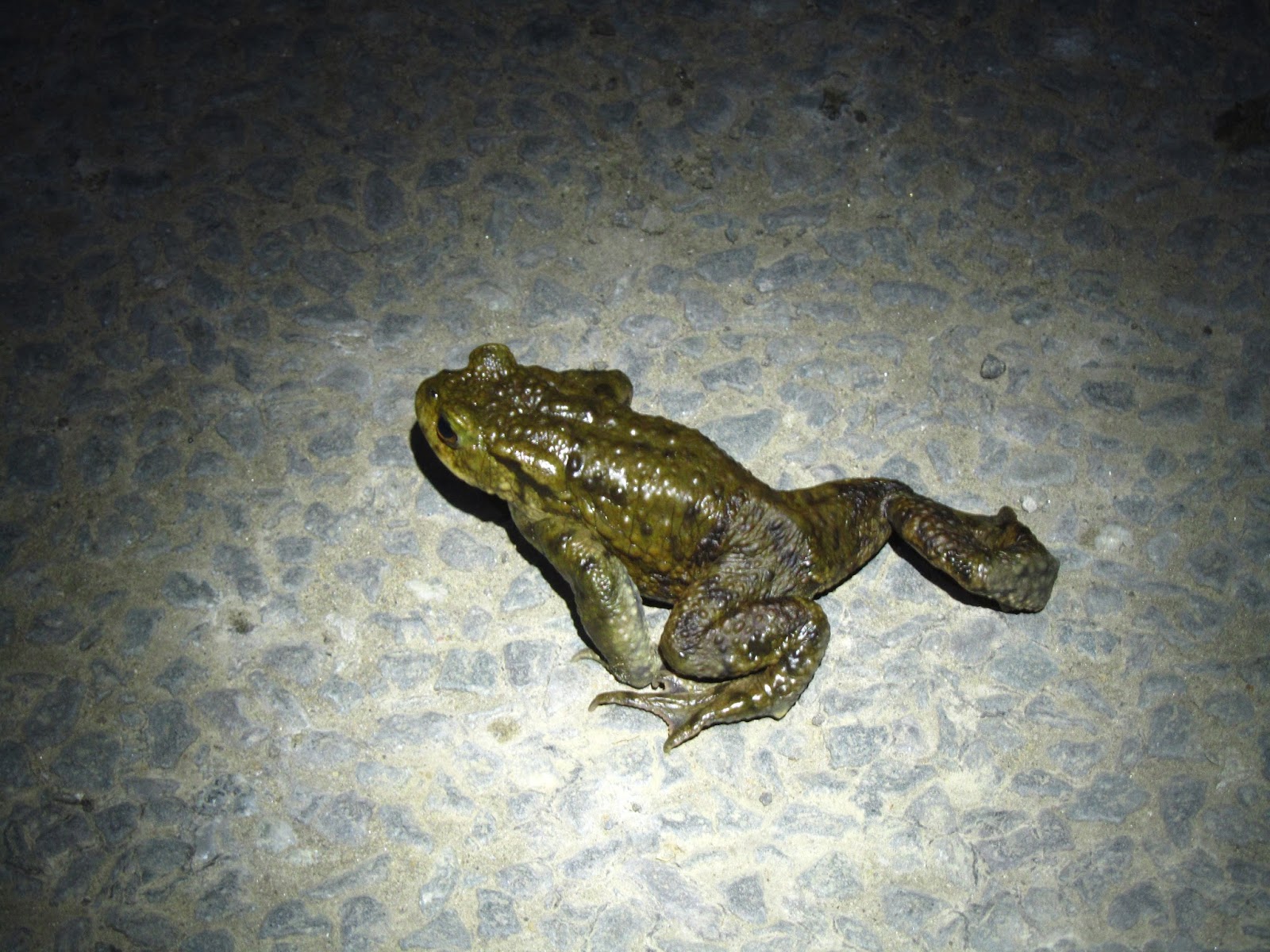
We set off from Cod Beck, having had a chat with some volunteers from the "Osy Toads", AKA the
Osmotherley Toad Patrol, whose aim it is to make sure as many toads as possible get safely across the nearby main road and to and from the Reservoir. As we set off, we saw quite a few toads resting on the road and I hope they had a successful onward jouney!
Conditions were great until we reached the ford at Hollin Hill after a couple of miles, when a light drizzle became a more persistent rain - time to get the waterproofs on. The weather calmed down after a while, so we had good conditions which is always nicer when tackling the Cleveland Hills.
In January the steep steps down from Carlton Bank and Cringle Moor had been icy and treacherous, so we were grateful for the milder March weather.
We opted to go round the tops of the Wainstones and Hasty Bank using the Broughton Plantation route and this path was much drier than I was expecting, so we made good progress on this section.
The climb up to Urra Moor is always a tough one, but knowing that this is the last big ascent for a long while helps put a spring in your step. By now it was getting a bit colder but after cracking open a couple of handwarmers we soon restored feeling in our hands!
When we hit the track at Bloworth Crossing weather conditions deteriorated rapidly and we were soon battling a howling wind and near-horizontal rain. Not what the weather forecast had told us, and these nasty conditions persisted from roughly 2am through to 5am. Our usual banter dried up whilst our bodies took a lashing, as we put our heads down and rode the storm.
We took the path via Flat Howe and this path is becoming much easier to navigate than it was a year ago. We stopped for a breather when we reached the road, and fortunately the rain started to ease, as I wasn't looking forward to crossing the bog in the wind and driving rain.
The rain stopped and the sun started to rise, making the route much easier to follow. I think this was the first time when crossing the bog that the path itself was apparent. We'd always just muddled our way through this section and more often than not in the dark, but here was an actual path for us to follow - amazing!
With a bit of daylight and better weather our spirits lifted and we were back to babbling our usual nonsense. We had a break for food at Shunner Howe, then headed down the wrong path as usual onto Hamer road, meaning going back up the road a short way to get back on the path through White Moor to Blue Man i'-th'-Moss. Conditions on this section were better than expected and after a quick stop to say hello to the man in blue, we made steady progress alongside the Plantation down to Wheeldale Road.
I love crossing Wheeldale Beck, in particular when the stepping stones are navigable. Despite the steep drop down to the beck, and sharp climb back up, this is a little green oasis after miles and miles of bleakness and a lovely place to rest.
We had another food stop at Simon Howe, with the next section over to Goathland Moor clear in our sights. By now it was apparent that we were making steady progress and we really had a spring in our steps all the way over to Fylingdales and up to Lilla Cross.
I always have a bit of a cheer at Lilla Cross, for a couple of reasons. Firstly the cross itself symbolizes the walk for me. Ancient, steeped in history and mythology, this stone is an indelible mark on the landscape that will outlive us all. Secondly, it also marks the spot where the end of the walk is in sight, so let's hear it for Lilla Cross.
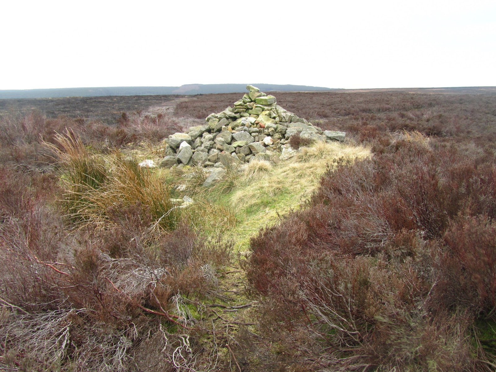
The walk across Fylingdales moor is long and draining and without much variation apart from the cairn at Burn Howe. Surprisingly this wasn't too boggy and before we knew it we were perched atop the drop into Jugger Howe. As always this is a test for tired limbs, but for me the variation in scenery more than makes up for it.
We were still steaming along, straight over the Whitby road and upwards towards the radio mast and Lyke Wake stone, completing in a very respectable 16 hours 30 minutes, and in good time to head to the pub and bed for the night.